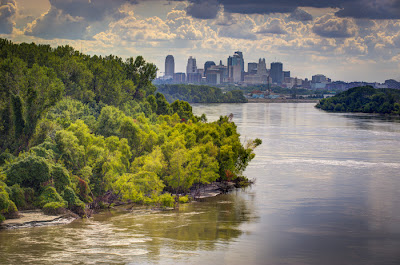
Showing posts with label Missouri River. Show all posts
Showing posts with label Missouri River. Show all posts
Friday, September 23, 2011
Saturday, September 10, 2011
Sunday, July 3, 2011
Bond Bridge Fully Lit

 Bond Bridge illuminated its LED lights along the sides tonight. They can be almost any color and move.... sliding red right to left, blue left to right, white from middle to sides.... very interesting.... makes for a very dynamic structure. Also another, much longer, fireworks display tonight from Riverfest.... good evening all round! Here's a link to a brief iPhone video of the fireworks... and you can see the LEDs changing. http://gallery.me.com/dremley#100622

Friday, July 1, 2011
Mighty MOcha
 32.5 feet today.... around 3pm.... supposed to fall now... but we should expect higher levels through August. In comparison, the 1993 flood crested at 48.9 feet. We are nowhere near that and shouldn't be. The only thing that could cause issues would be levee seepage... the barriers aren't designed to hold back waters permanently... today I saw pick-up trucks driving the levee tops checking for anything amiss.
 The water is quite rapid.... enough so that the bridge supports leave wakes..... lots of tree trunks and branches in the water too. All recreational boating is banned and barge traffic has a voluntary ban....

Saturday, June 4, 2011
Twenty-Eight Feet and Counting
 Not as high as 1993...... yet... work on removing the old Paseo Bridge continues.... deck is completely gone.. vertical supports going next.
 As marvelous as the bridge is.... a simple thistle is just as becoming... although less functional in our eyes I suppose.
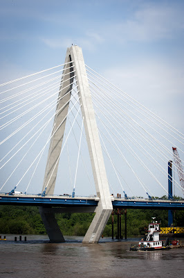 The river is flowing very fast and is a deep chocolate color with lots of debris.

Sunday, March 6, 2011
Filigree Intent
Monday, November 22, 2010
Bond Bridge First Lighting

I was privileged to be riverside as the first set of Bond Bridge lights were turned on for the first time. Each of the cables is illuminated individually with cannon spots. Later on the L.E.D. lights will be turned on along the sides of the deck. Those can be any color and even controlled individually. The Bridge was completed six months early and the Paseo Bridge was retired last Friday. It really is gorgeous. I can see lots of riverside visits in my future. This shot is looking northwest and was taken at 6:15pm. It is seven shots at varying exposures sandwiched for the final product. Nikon D3 was tripod mounted, ASA 1000, Nikon 14-24mm set at 24mm.
I was going to post Part 2 of the Pendleton Heights Holiday Homes Tour tonight, but I will postpone that until tomorrow.
Monday, August 2, 2010
Walking by the Mighty Mo
Tried the new river walk on Sunday..... which allows a person to travel from Main street almost all the way to Paseo Boulevard along the Missouri River.
 Above looking east toward the ASB Bridge, below looking west toward the Broadway Bridge. Old mooring post in the foreground below with wire rope still attached.
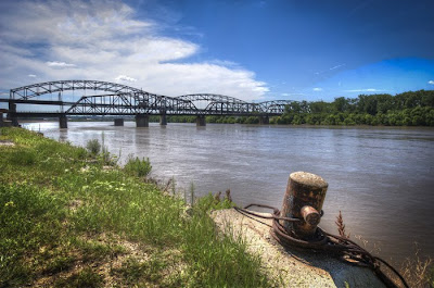 And yes, the Mighty Muddy Mo is Mighty Muddy. As Twain said: "too thick to swim in and too thin to walk on."
 Above the ASB Bridge which stands for Armour (Packing Co.) Swift ( & Company) and Chicago, BURLINGTON (and Quincy Railroad). The piers were built in 1890 but sat unused until 1909 when construction of the rest of the bridge began. It consisted of two decks the upper for cars and trucks and the lower for trains. The bridge, as you can see, is very close to the surface of the water right now which is one reason why the center portion is counterweighted and can be raised. Bridge designers made it possible to do this without disturbing the top deck so traffic was not impeded. After the Heart of America Bridge was finished in 1987 the ASB's top deck was removed. It is a National Landmark in Civil Engineering and is owned now by the Burlington Northern Railroad. Note the pathway goes down under the bridge....on the right in the image. The path is handicap accessible and is for biking or walking.
 Areas next to the trail have been planted with native grasses and other plants which should make it look a lot like it did when Lewis and Clark came by just after 1800.
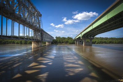
 Above, ASB on the left showing one of the massive piers. The piers were originally 9 stories tall in 1890 when completed but were lowered to just 10-feet over the high water mark.
 Another view of the Bond Bridge looking east above and below the ASB and The Heart of America Bridges.
 Below.... "adaptive reuse" sorta. An old administrative building which was in horrible shape has been stabilized and even has flower boxes in the windows.
 To access the walkway you can take Grand down to Berkley Park and then walk west, or, park at the foot of Main, walk out on the tower and then down by stairs or elevator to the walkway.
Saturday, July 31, 2010
South Shore Awaits
 Journeyed down to the rivers edge to check on the Bond Bridge construction. Tons (literally) of progress to report including the fact that it's almost shore to shore. Very small, relatively speaking, space to go before the span touches north and south banks. Above is the view from above the Isle of Capri fake water feature.... the casino takes river water and pumps it through their grounds and then that circuit is complete with the return to the stream shown above.
 Above a panorama under the south end of the bridge showing the only gap that remains to be closed. Paseo Bridge is on the left. The new bridge is scheduled to be finished by this time next year.
 The north end was constructed using steel supports.... after the midpoint was reached the southern half of the bridge was cantilevered out since the river channel had to be kept open for barge traffic. The river's high level this year has slowed progress somewhat since much of the work is done from barges which also bring a lot of the supplies out to the work site.
 When finished and illuminated by thousands of led lights that will be computer controlled the bridge will be stunning...

 The top of the delta pylon is roughly 316 feet above the river's surface....
 As mentioned previously tugs, like the one pictured above, scurry around the supports of the structure all day.
 The remaining gap between in the bridge near the south shore seen above. Below, that same gap from the endpoint.
 Above and below the deck will soon stretch completely across the river.... in the above photo you can see the small crane atop the delta pylon which ferries men and equipment to the top.
Saturday, May 29, 2010
Moon Rise From Kaw Point
 Friday night was the last time the moon would be full-full... from now on it will start losing its roundness. Above is the dusk view of the skyline with the relatively newly installed metal sculptures of Lewis and Clark. The Kaw River is on the right and the Missouri is on the left. Both are high and moving fast from all the spring rains.
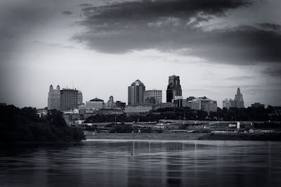 It's a view that lends itself to black and white as well as color... above and below the skyline just after sunset.
 Above...taken at 9:45pm..... the moon rose at 9:44pm and made its first appearance (below) at 10:10... preceded by a decided glow around the building. Fortunately what few clouds there were dissipated before moonrise.
 The moon is very bright in relation to its "surroundings" and the only way to get detail in it is to sacrifice outlines and shapes in the buildings.... above is such a shot.
 All these shots, except the last one, were taken with the 70-200 f2.8 zoom at F16... I varied only the shutter speed in capturing the images and it ranged from 2 seconds to 8 seconds at ASA 800 on the Nikon D3. A tripod and cable release were used to make sure everything was perfectly steady.

 Fiddled with the color balance on the one above. Others are pretty much as seen by the naked eye.

 Above shot was taken with same settings as before but using the 24-70mm zoom... it was a parting shot on the way back to the parking lot. The park is easy to find... just take the Lewis and Clark Viaduct (appropriate) west and take the Fairfax exit... then look for a sign on the right with an arrow saying "Kaw Point". You travel through a shipping yard parking lot to get to it... just follow the signs.
Subscribe to:
Posts (Atom)


